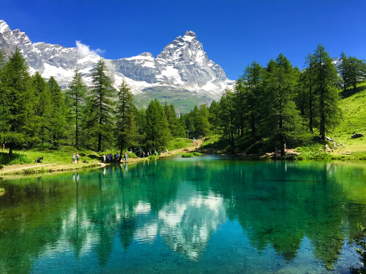
Lago Blu, from the Hotel Chalet Valdotain car park

Edited by:
Massimo Martini
Updated at: 22/07/2026
Access
Road directions
Take the motorway exit at Châtillon-Saint-Vincent and follow Via Emilio Chanoux towards the town centre. At the roundabout, take the third exit and continue along Via Emilio Chanoux for 600m (0.9km), then turn right onto Via L. F. Menabrea. At the next roundabout, take the second exit and join the towards Valtournenche. Follow the for 25.0 km (25.9 km) towards Valtournenche and Breuil-Cervinia, until you reach your destination on the right.
Car park
At the Hotel Chalet Valdotain, in the Lago Blu area on the outskirts of Breuil-Cervinia, there is a 🅿️ car park reserved for guests of the hotel.
Access by public transport
The Chatillon/Breuil-Cervinia route, operated by Arriva (formerly SAVDA), stops at Breuil - Lago Blu, just a short walk from the starting point, with several services daily. Please check the up-to-date timetables on the Arriva Valle d'Aosta before setting off.
Distance and journey time
🕒 journey time: 38 minutes
📏 distance: 25.9 km
GPS navigation
Important information
The directions provided were verified on the date the route was mapped. Before setting off, we recommend checking for any changes to the route or road conditions. For up-to-date information, please consult Google Maps or Apple Maps.
Introduction
A short circular walk that follows Regional Road 46 in the Valtournenche, just above the village of Breuil-Cervinia, ending at Lago Blu — also known as Lago Layet, one of the lakeswater in the Layet lake group. The route runs almost entirely on flat ground through a larch forest and takes you all the way round the lake, whose surface reflects the Matterhorn on clear, windless days. The absence of significant elevation changes makes the route suitable for children and older people too, although a short section of steps at the start requires the ability to walk unaided. The best time to visit is [to be completed]. There are no major difficulties, except for snow cover or ice forming on the path during the colder months.
Description
0h00' 0.00km From the car park at theHotel Chalet Valdotain, in the Lago Blu area along the , climb about ten steps to the western shore of Lago Blu, surrounded by a larch forest (Larix decidua). Take the path that circles the entire lake, passing a second access point from the regional road, until you reach the southern shore of the lake, facing the Matterhorn, whose silhouette is reflected in the water on clear days. Complete the loop by descending the same route you took on the way up to the starting car park (1,977 m) 0h15' 0.36km (11 m elevation gain) (11 m elevation loss).
Comments (0)
Sign in to leave a comment